Lake Como Italy,Menaggio,holiday apartments for rent from private owner,flats to let,vacation houses,holiday rentals....
Apartments for rent in lake Como , Menaggio,Italy.Vacation rentals holiday accommodation from private owner,flats to let ,holidays in Menaggio lake Como,rental apartment,house rentals


Apartments for rent in lake Como , Menaggio,Italy.Vacation rentals holiday accommodation from private owner,flats to let ,holidays in Menaggio lake Como,rental apartment,house rentals    Apartments for rent in lake Como , Menaggio,Italy.Vacation rentals holiday accommodation from private owner,flats to let ,holidays in Menaggio lake Como,rental apartment,house rentals    Apartments for rent in lake Como , Menaggio,Italy.Vacation rentals holiday accommodation from private owner,flats to let ,holidays in Menaggio lake Como,rental apartment,house rentals    Apartments for rent in lake Como , Menaggio,Italy.Vacation rentals holiday accommodation from private owner,flats to let ,holidays in Menaggio lake Como,rental apartment,house rentals    Apartments for rent in lake Como , Menaggio,Italy.Vacation rentals holiday accommodation from private owner,flats to let ,holidays in Menaggio lake Como,rental apartment,house rentals
  Menaggio Lake Como Italy
home
apartments
menaggio
Lake Como
tel. +39 338 6085190
e-mail   info@milohouse.it
holidays in Italy,properties for rent directly from private owner in Menaggio, Lake Como Lombardy

"TREKKING LA VIA DEI MONTI LARIANI"

villas accommodations lake Como holiday rentals to let self catering vacancy flats vacation home apartments Italy Lombardy Menaggio lake Como accommodation vacation apartment apartments house

"Via dei monti Lariani"

LA VIA DEI MONTI LARIANI. The old tracks which cross the mountains on the west side of the lake and were used - and are used still - by the local people to reach the Alpine pastures called 'Monti' ('Munt' in the local dialect) have been transformed into a series of paths following a marvellous itinerary called 'LA VIA DEI MONTI LARIANI', Lario being the ancient name of Lake Como. It is a beautiful hiking trail of 125 km. stretching out at an average height of 1000 m., most “monti” being situated between 600 and 1200 m. The "Via dei Monti Lariani" is divided into 4 sections. The first one leads from Cernobbio to the Val d'Intelvi and is 28 km long, the second section leads from the Val d'Intelvi to the Val Menaggio (26 km), the third leads from the Val Menaggio to the Val Albano (24 km) and the fourth from the Val Albano to Sorico (46 km). The trail is well-marked with red-white-red signs in aluminium on tree trunks or walls, or painted on rocks numbered from 1 to 4 according to each section. It's impossible to walk the whole 'Via' in 4 days, because the sections are too long and one has also to deal with the differences in altitude; 6 days would be the minimum amount of time needed. The times indicated in the description are for experienced hikers. This brochure, also provides a list of the lodging possibilities on the 'Via': refuges (most of them are only open in July/August every day and in May/June - September/October only on Saturday-nights), small hotels or “locandas” in the villages the trail passes through. One can also just follow small sections of the trail, the roads, mule tracks and hamlets you meet on your way, give you numerous possibilities to return down to the lake.

Available maps: La Carta dei Sentieri della Comunità Montana Lario Intelvese scale 1:35.000, La Carta Topografica Escursionistica Comunità Montana Alpi Lepontine scale 1:25.000 and La Carta dei Sentieri della Comunità Montana Alto Lario scale 1:35.000 or Kompass map 91 Lago di Como - Lugano and Kompass map 92 Chiavenna-Val Bregaglio, or Kompass map 676 'Sentiero Italia - Tratto Nord Lombardia Scale 1:50.000.

Via dei Monti Lariani - Path 1
villas accommodations lake Como holiday rentals to let self catering vacancy flats vacation home apartments Italy Lombardy Menaggio lake Como accommodation vacation apartment apartments house


villas accommodations lake Como holiday rentals to let self catering vacancy flats vacation home apartments Italy Lombardy Menaggio lake Como accommodation vacation apartment apartments house


villas accommodations lake Como holiday rentals to let self catering vacancy flats vacation home apartments Italy Lombardy Menaggio lake Como accommodation vacation apartment apartments house

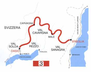
"Via dei monti Lariani - path 1"
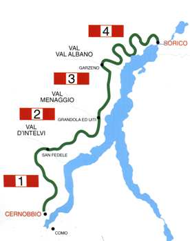
PATH 1
CERNOBBIO - SAN FEDELE D'INTELVI
Time: 9.30 HOURS
Distance : 28 KM

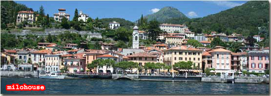
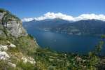
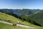
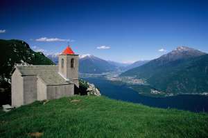
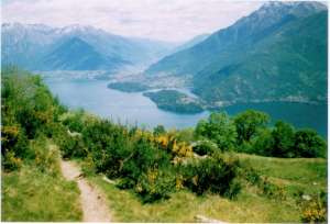
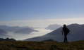
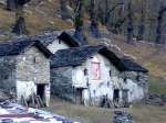
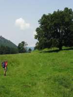
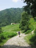
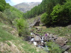
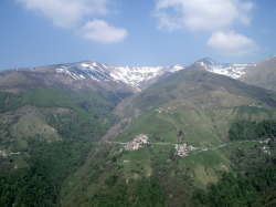
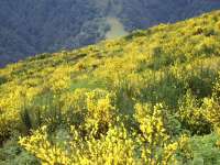
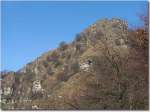
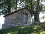
CERNOBBIO (200 m.) The 'VIA DEI MONTI LARIANI' starts at Cernobbio in Piazza Mazzini where the main bus stop is. Cross the main road, pick up Via A. Volta and when you get to a circus continue straight on in the direction of Rovenna and Monte Bisbino. At the end of the road, just past the bend, after 20 m, pick up Via G. Parini on the left. Once on the road again, follow it as far as Casnedo and at the church turn right. Cross a bridge and take left and pass through the village Stomaino. A shortcut leads to ROVENNA (450 m. 0.45 hours) – which can also be reached by bus (line C28) from Cernobbio. You pass the church square (where also the bus stop is). At the bend turn left following the indications for Scarone and Madrona. After a brief stretch you reach the beginning of the mule track that leads up in large bends to MONTE SCARONE and from there to MADRONA (850 m. 1.00 ; 1.45 hours). Follow the road up to the second curve, where you pick up the mule-track to Monte Bisbino which passes by the chapel of S. Carlo. At the end of the mule-track, before reaching the road leading to the top of Monte Bisbino turn right in order to reach CA' BOSSI (1188 n. 1.00 ; 2.45 hours). From here a wide track goes slightly downhill to COLMA DAL BUGONE (1200 m. 0.40 , 3.25 hours).– Rifugio Bugone - This is where two paths coming up from Moltrasio meet. You pass ancient beech-woods and get beautiful views of the lake, the Western Alps, Monte Generoso and Sasso Gordona. Past COLMA DEL CRINCO the 'VIA' leads on to the COLMA DEI MURELLI (1200 m 0.45 ; 4.05 hours).– Rifugio Murelli From this point you can make a detour of about half an hour to Monte Colmegnone (1383 m.), which has a magnificent view, or Monte San Bernardo (1348 m.) with its characteristic little church. From here an easy cart-track leads to ALPE DI CARATE where you pick up the mule-track to RIFUGIO BINATE (1200 m. 0.35 ; 4.40 hours) From here the mule-track becomes a path which runs half way up the mountainside, the Swiss-facing slope, through fields and alpine pastures to COLMA DI SCHIGNANO (also called delle Crocette) (1135 m. 0.20 ; 5.00 hours) from here it’s possible to go down to Schignano (0,45 min) where there is a bus stop or to Argegno (2.00 hrs). At the next intersection at the height of a cross, take right over to the side that faces the Val d' Intelvi and continue on an old military road that leads around Sasso Gordona. Inside this mountain there are tunnels with emplacements. In fact Sasso Gordona was part of the great defence line called Linea Cadorna, built in 1915 along the Swiss-Italian border, to thwart a possible German offence. At the intersection with the indication Alpe Cerano / San Fedele turn right. (The ones who have booked an overnight stay at Rifugio Prabello go straight on and will reach the “rifugio” in about 15 min.) An easy track leads down to ALPE DI CERANO (960 m 0.50 ; 5.50 hrs) (also called Pian delle Alpi) - road connection with Casasco 40 min. where there is a bus stop (line C21). Follow the road Casasco to Erbonne to the right, and just past the pic-nic area leave the road and pick up the mule-track to the left in the direction of Erbonne (sign). At the intersection with some trail signs on a tree, turn right and follow the track that leads up the farm house of ERMOGNA. Before reaching the farm house you pass a “bolla” a natural depression in the terrain adapted by man to conserve rainwater and create a beverage place for the cattle. Near the farmstead you notice a cylindrical formed construction called “nevera”. These constructions out of stone, which lead deep into the ground, were filled with snow (neve) and used in the summer to conserve food. The easy track leads to MONTE di CAROLZA (1100 m.). and from there after a stretch through the woods you reach some recently built houses above the town Casasco. Take left and follow the sign for Capanna Bruno / San Fedele. Then you reach the road coming up from Casasco, follow it to the left and just past to the bend with three crosses, leave the road and take the trail on the left as it leads up to the restaurant CAPANNA GIUSEPPE AND BRUNO (1180 m. 1.30 ; 7.20 hours). Just past the restaurant on the right you find the trail signs for Alpe Orimento / San Fedele. An almost flat trail leads over the steep fields of Mt. Crocione, and crosses under a ski lift. The trail leads on to a track and after a stretch downhill at the intersection, take the trail left leading uphill. At the next intersection keep left again in order to reach BOCCA DI ORIMENTO (1275 m. 0.45 ; 8.05 hours) restaurant, starting point of the excursion to Monte Generoso (1701 m.) Follow the road leading down to Casasco to the right and after approx. 2 km you reach RIFUGIO CRISTE' (1250 m.) You remain on the road (there are some shortcuts in order to cut some bends) which leads around two “bolle” and arrives at an intersection. You leave the road leading to the right to Casasco but follow the road left in the direction of San Fedele. After 300 m you leave it and pick up a large cart track on the left leading to some houses. The cart track becomes a comfortable grassy trail, that leads through a pinewood and then down through meadowland in the direction of SAN FEDELE, with splendid views of the VAL D'INTELVI and the mountains of the Canton Ticino. The trail leads on to the road leading down to the town SAN FEDELE D'INTELVI (750 m. 1.25 ; 9.30 hours)- hotels - restaurants – bus stop (line C20/21/22). where this section ends near the bus depot.

Via dei Monti Lariani - (path 2)
villas accommodations lake Como holiday rentals to let self catering vacancy flats vacation home apartments Italy Lombardy Menaggio lake Como accommodation vacation apartment apartments house


villas accommodations lake Como holiday rentals to let self catering vacancy flats vacation home apartments Italy Lombardy Menaggio lake Como accommodation vacation apartment apartments house


villas accommodations lake Como holiday rentals to let self catering vacancy flats vacation home apartments Italy Lombardy Menaggio lake Como accommodation vacation apartment apartments house

"Via dei monti Lariani - path 2"

PATH 2
SAN FEDELE D'INTELVI - CROCE
Time: 9.00 HOURS
Distance : 26 KM

SAN FEDELE (750 m.). San Fedele can be reached by bus from Argegno (line C20/C21) or from Porlezza (line C22). From the bus depot (deposito delle corriere) where there is also a bus stop, cross the main road and follow the road leading past the cemetery to the upper part of the town; a wide track leads up to BELVEDERE (940 m.) with a good view over the valley. Pass through COIA and from there follow a trail through the woods that leads to a group of farm buildings called LA ZERLA (1150 m. 1.40 hours). You enter a pinewood, and then a beech wood, to arrive at some steeply sloping meadows near the alpine pasture of BASSETTA BASSA (1300 m. 0.45 ; 2.25 hours) from where there is a magnificent view of the Ponna Valley and the mountains around Lake Lugano. Pass right in front of the ruined farm buildings and go down to the right and pick up a trail (there is a yellow sign) which leads through the woods to ALPE DI COLONNO (1300 m. 0.30 ; 2.55 hours) You skirt the old barbed wire fencing of the “alpeggio” and walk up to the big metal cross (beautiful view). From here go down to the road place for cattle. You soon arrive at the mountain refuge BOFFALORA (1250 m. 0.20 ; 3.15 hours) surrounded by beautiful pastures. From Boffalora follow the old military road leading into the direction of Rifugio Galbiga (Rifugio Galbiga 1576 m can be reached in about 1 hr). Also this area was part of the great defence line called Linea Cadorna, built in 1915 along the Swiss-Italian border, to thwart a possible offence. You leave the road at the first bend and go up to the right where you find the trail sign for Grandola ed Uniti. The 'VIA' then follows the upper part of the Perlana Valley through the woods, passing the farm buildings of PIODA (1256 m. 0.40 ; 3.55 hours). After you have past la TAIADA the trail leads out of the woods and over an open pasture, with a beautiful of the Val Perlana you reach ALPE GADA (1260 m. 0.50 ; 4.45 hours) and then PIAZZA from where there is a beautiful view of the lake below and the surrounding mountains. You can also see the Monastery of San Benedetto below you, an important Romanesque building. The path starts going downhill passing CRUSEN and GARBAGNO. Just past Garbagno you leave the steep mule track leading down to Lenno (1.00 hrs) and pick up a track to the left leading to NARRO (988 m. 1.00 ; 5.45 hours). Above the settlement you pick up another trail to the right leading through the woods (this part of the trail can get somewhat overgrown) to OSSINO (1010 m. 0.45 ; 6,30 hours) from where you can enjoy a beautiful view of the lake. From Ossino there is a track leading down to Mezzegra (1.20 hrs). Past two rocky valleys you come out onto a military road, hewn out of the rock and running through a 120 m. long tunnel. Also this is part of the fortifications carried out during the First World War, from Monte Bisbino to the Val d'Intelvi and the Menaggio Valley. After the tunnel, you go down to the pastures of MONTI BRENTE’ (880 m.) and then along another old military road to BOCCHETTA DI NAVA (848 m. 1.45 ; 8.15 hours) - you can reach Griante from here (1.00 hrs). On your way down to CROCE, you walk through beautiful chestnut woods, and past MIE' you reach PAULLO (650 m.) in the Menaggio Valley. You leave the entrance of the Menaggio - Cadenabbia golf-course on the left and follow the road down to the right to CROCE (385 m. 0.45 ; 9.00 hours) hotel - restaurant - bus stop (line C12), which is a hamlet part of the township Menaggio only 2 km away. Near the church square path 2 finishes. Follow the main road to the right and after 20 m you find the bus stop for Menaggio (line C12) and on the other side of the road for Grandola – 1 km from Croce - (Line C12) where path 3 starts.

Via dei Monti Lariani  (path 3)
villas accommodations lake Como holiday rentals to let self catering vacancy flats vacation home apartments Italy Lombardy Menaggio lake Como accommodation vacation apartment apartments house

villas accommodations lake Como holiday rentals to let self catering vacancy flats vacation home apartments Italy Lombardy Menaggio lake Como accommodation vacation apartment apartments house

villas accommodations lake Como holiday rentals to let self catering vacancy flats vacation home apartments Italy Lombardy Menaggio lake Como accommodation vacation apartment apartments house

"Via dei monti Lariani - path 3"

PATH 3
GRANDOLA ED UNITI - GARZENO
Time: 9.0 HOURS
Distance: 25 KM

GRANDOLA ED UNITI (385 m.) can be reached by bus (line C12). Get off at the bus stop 'bivio per Naggio' (turning for Naggio). You are now at CARDANO (part of the township Grandola). Turn into 'Via Carlo Galbiatti' where path 3 starts. From here follow the road (there are a few short cuts) to CODOGNO (479 m. 0.15 hours). Here, on your left, you can see the 17th century Villa Camozzi which is now seat of the town hall, as well as cultural centre and seat of the Naturalistic Museum of the Valley Sanagra. Just past the villa turn right and follow the road leading down to the Agriturismo “La Vecchia Chioderia” with a trout nursery (troticultura), restaurant and inn on the Sanagra river. Cross the bridge and just past the “agriturismo turn left and then almost at once right and follow a steep path that winds up to BARNA (563 m. 0.35 ; 0.50 hours). Cross through the town (pay attention to the signs on the houses) with it's pretty church square. Leave the town behind you where a steep mule track leads uphill through the woods and passes a fountain with three arcades. The mule track eventually becomes a somewhat unclear path that ends on a cart track near a house which you follow left. In a brief time you reach LA PIAZZA (747 m. 0.30 ; 1.20 hours) surrounded by beautiful pastures where the track ends on a road near a little chapel called cappelletta del Bergum. NB Beware that the sign with a number 3 crossed with a red stripe indicates the '4 Valleys Trail', another beautiful itinerary of 3 days. Follow the road to the left for just a brief stretch, then leave it and follow a track to the right through the woods in an area where there are many summer residences. Just past the Chiarella mineral water spring, you reach BREGLIA (749 m. 0.40 ; 2.00 hours) Refreshments available hotel, bus stop. For those starting this section at Breglia, from the bus stop pick up the road leading to Rifugio Menaggi to the left and follow it for about 50 m. Then at a recently constructed residence turn right into the little alley and follow the signs for path 3. NB Beware that the sign with a number 3 crossed with a red stripe indicates the '4 Valleys Trail'. You follow the easy track leading out of town and after10 min. you arrive at a fork where you pick up the mule track down to the right. It leads through the chestnut woods down into the Val Greno, crosses the valley over a little bridge, and leads the hamlet Carcente. In the middle of this nice hamlet beware not to miss the turn of to the left in order to pick up the cobbled track leading in bends up to MONTI DI CARCENTE (847 m. 1.20 ; 3.20 hours). From there the path leads to MONTI DI TRECCIONE and on to fields with a magnificent view of the Lepontine Alps, the northern end of the lake and the Lecco branch before reaching MONTUGLIO (950 m ) road connection with Rezzonico (1.30 hours). The path then goes through the Vezzedo valley, and then on to Luina and to the beautiful MONTI DI BRACCO (1060 m. 1.00 ; 4.20 hours) coastal connection with Cremia (1.45 hours). Just past the little church of S. Domenico, you continue on to MONTI PIAZZUCCO. After an uneasy stretch through the dry and rocky Quaradella Valley you reach NARO (1190 m. 0.50 ; 5.10 hours) surrounded by a pinewood. From the fountain in the middle of the houses the trail continues to the pasture fields of Alpe N'ALCIM (1200 m.), with beautiful view of the surrounding peaks. A bit further, and you are at the highest point (1250 m) of this particular section, near Val Grande. The path then starts going gently downhill and keeping to the right, leads through the rural settlements : ADACA and SCRIRESÖ. Among pasture fields you pass through BRECCHIO and the upper part of LABBIO (1020 m. 1.50 ; 7.00 hours) Agriturismo Labbio. From Labbio the path climbs to the SADDLE OF SAN BERNARDO (1105 m. 0.20 ; 7.20 hours). From the church you can see the Valley of Albano where the trail leads down to. Ignore the trail down to the right leading over Sasso di Musso to Musso but pick up the one on the left. The trail descends the steep fields of the northern slope of Monte Bregagno crosses some small streams and eventually leads to the rural settlement PIAZZE (800 m. 0.40 ; 8.00 hours). Right at the beginning of the settlement, where you find the yellow sign indicating its name, you turn to the right in the direction of CATASCO. At the lower part of the hamlet you will find the recently constructed road that leads down through a beautiful chestnut wood to the bridge over the river Albano. You soon arrive at CATASCO (620 m). from where you follow the track leading up to GARZENO (662 m. 1.00 ; 9.00 hours) Bus stop (line C17) refreshments - 2 hotels.

Via dei Monti Lariani (path 4)
villas accommodations lake Como holiday rentals to let self catering vacancy flats vacation home apartments Italy Lombardy Menaggio lake Como accommodation vacation apartment apartments house


villas accommodations lake Como holiday rentals to let self catering vacancy flats vacation home apartments Italy Lombardy Menaggio lake Como accommodation vacation apartment apartments house


villas accommodations lake Como holiday rentals to let self catering vacancy flats vacation home apartments Italy Lombardy Menaggio lake Como accommodation vacation apartment apartments house

"Via dei monti Lariani - path 4"

PATH 4
GARZENO - SORICO
FIRST PART : GARZENO - PEGLIO
Time: 8.00 HOURS
Distance: 24 KM

GARZENO (662 m.). You can reach Garzeno by bus (line C17) from Dongo. From the bus stop in the Church square follow a steep path marked with a 3 superimposed by a 4 (path 3 used to pass here) as far as a waterworks cabin. You cross the field keeping to the right and follow a trail which leads to L'AVOLO (865 m.), a picturesque little hamlet. Once you reach the houses (once the roofs were in straw) you end up on a wide track which you follow to the left, and just before reaching a small chapel, you leave the track and pick up the trail leading up to the right to SANT'ANNA (870 m. 0.45 hours) - trattoria -. From the “trattoria” you follow the road GARZENO-GIOVO for a small stretch then at the bend you pick up the mule track leading down to CAGNAO (885 m.) Cross the field and pick up the trail leading into the woods which leads out of the Val Albano to the mountains dominating the lake. You end up on a road which you follow but at the bend at the settlement CRAGNO (850 m) you pick up the cart track to the left which leaves the mountains facing the lake but leads into the valley. Keep on the even track but leave it at the settlement STABIE’ to descend to IEVIA (810 m.). An asphalt road leads from here to the byres of NESSA, where you leave it and turn down to the right and then and over a path through thick woods you arrive at the clearing of L'AGNONE (920 m. 1.30 ; 3.00 hours). Near a fountain. The 'VIA' then leads on amongst mountain-ridges and mountain streams to the cattle byres of LAMBROSETTO ( 980 m.) and BADALUCCO. The path then leads downhill through wild scenery to the S. Jorio valley. Beware of possible landslides in this area! In the distance you can make out the arch of the old BUDANGHEL bridge (985 m. 0.50 ; 3.50 hours) which you cross. The 'VIA' then passes, half way up the mountain slope, several groups of cattle byres out of stone with an interesting architectonical style. The trail ends on to a cart track near a small bridge and leads to BOIENA (960 m – picnic area). After a few hundred meters the cart track ends and you continue on a path. Through woods and over fields you enter the heart of the Val del Dosso to meet with a path signed with yellow paint which leads to Rifugio Vincino. After you pass a bridge you reach PIAZZA (998 m.) From here a mule track leads steeply down to the VINCINO bridge (828 m. 1.30 ; 5.20 hours) over the river Liro. At the other side of the bridge, an easy trail leads uphill over steep fields, passes some isolated farm buildings, and ends up on a cart track. When you reach the road leading up from DOSSO DEL LIRO you follow it as far as CARZAN, from where a cobbled mule track leads down to DOSSO DEL LIRO (625 m. 1.30 ; 6.50 hours ) – bus stop (line C18). Follow the road downhill; leave it at the first bend and follow a path to the left leading into the Val Inferno. After passing the stream Ronzone the trail leads half way up the mountain slope past ARECC (702 m. 0.40 ; 7.30 hours) and gets down to the road PEGLIO-LIVO near the little church La Madonna di Pian di Gorghiglio. This section finishes here. To continue turn left to Livo, in order to reach PEGLIO (650 m. 1.30 ; 8.00 hours) – bus stop (line C18) - refreshments – locanda turn right.

PATH 4
SECOND PART : PEGLIO - SORICO
Time: 8.00 HOURS
Distance: 22 KM

PEGLIO (650 m.). Peglio can be reached by bus (line C18). From Peglio you follow the road in the direction of Livo passing the little church of la Madonna del Pian di Ghorghiglio where the section Garzeno – Peglio of path 4 ends. Once at LIVO (657 m.) refreshments available – bus stop you cross the village centre and then follow the road leading to Dangri past the cemetery where the antique church S. Giacomo stands. From here the cart track continues down to characteristic stone bridge PONTE DI DANGRI (659 m. 1.15 hours) on the Livo stream where there is a typical inn. After you cross the bridge you turn right, the path to the left leads to Capanna Como on lake Darengo. After a few meters ignore the track on the left leading to the Val di Bares but follow the Livo stream to the right on a not very well defined path. At a group of farm byres, it goes down to the streambed which you follow for a few hundred meters, and then you go up to left to the farmhouses of BARRO (617 m. 0.20 ; 1.20 hours) an interesting rural settlement. From here the path leads steeply down hill to the Bares stream. Pay attention to eventual landslides. NB After a long period of rain it might be difficult and in some cases even impossible to cross the stream. After passing the Bares stream you climb up a steep path through the woods which reaches a group of farmsteads standing on a small saddle. From here the ascent continues to PUII (800 m) out of the woods surrounded by fields with a beautiful view of the Livo valley. Then it goes up to TROBBIO (950 m. 1.40 ; 3.00 hours). From the fountain move to the upper part of the settlement and from here to the right a path half way up the mountain slope leads to TABBIADELLO (980 m. 0.30 ; 3.30 hours) with a marvellous view of the northern part of the lake, Pian di Spagna and the surrounding mountains. Cross the cemented track leading up from Domaso and pick up the even trail that leads to Roncai and from here into the SAN VINCENZO VALLEY. The trail reaches INCISA (950 m. 0.45 ; 4.15 hours) and from here continues deep into the valley. Then it goes down steeply through a birch wood, mind the land slides, to the stream which you cross over a bridge. The path climbs up the other side of the valley. Out of the woods it goes half way up the mountain slope to MONTALTO (1030 m. 0.45 ; 5.45 hours) - refreshments and lodging available at Rifugio Alpino d'Alco. Road connection with Gera Lario (2.00 hours). The path leads through the village and gets to the asphalt road. Those who want to get to the Rifugio Alpino d'Alco follow the road down to the right for about 10 min. The "VIA" though continues over the road to the left. After 200 m you pick up a mule track on the left that crosses some fields and then again ends on to the road. From here the path leads into the valley of Sorico, overlooked by Monte Berlinghera (be careful, in this area for possible landslides). You cross two streams and then the path climbs up to the other side of the valley and then evens out at the fields of PIAZZA LUNGA (965 m.) From here follow the cart track for a brief stretch and then take the path on the left which in a short time leads to FORDECCIA (1094 m 1.30 ; 6.30 hours) - Agriturismo Giacomino - road connection with Gera Lario (2.00 hours) right in front of rifugio Fordeccia , you go down the fields with a view of Sasso Manduino, and you reach the cart track that leads to COLORINA and from there to SASS OLT (950 m.) Marvelous view of Lago di Mezzola and Val Chiavenna. The path passes various settlements and goes down through thick chestnut woods to the clearing of POZZI. The descent continues to SELVE (469 m.) From the fountain of the village the path leads down to the beautiful church SAN MIRO. From here it is only a brief stretch to SORICO (213 m. 1.30; 8.00 hours) – bus stop (line C10) hotels - restaurants where path 4 finishes.

"TREKKING - IL SENTIERO DELLE 4 VALLI"

Dimora Li...Sogno -

"IL SENTIERO DELLE QUATTRO VALLI"

IL SENTIERO DELLE QUATTRO VALLI - the 4 Valley Trail, - is a beautiful hiking trail about 50 km long. It starts at Breglia, a small mountain village, 7 km above Menaggio and leads through 4 different valleys: the Val Sanagra, Val Cavargna, Val Rezzo and Valsolda ending at Dasio, a little town situated above S. Mamete on Lake Lugano. The trail is divided into 3 sections. The first one leads from Breglia to Malé and is 13 km. long, the second section starts at Malé and ends at Cavargna and is about 19 km. long, and the third leads from Cavargna to Dasio (13 km). You can hike each of these sections as a day-excursion, or you can hike for three days, spending the night at one of the “locandas" you find at the end of each section, make reservations before starting the walk. The trail follows a mean height of about 1000 m and reaches its highest point of 1400 m at Alpe Coloné in Val Cavargna; it is marked by red-white-red signs with a number 3 crossed with a red stripe. The times indicated in the description are for experienced hikers. The ideal time of the year for this hike is from May till the end of October.

Available maps:
Carta Topografica Escursionistica
by the Comunità Montana Alpi Lepontine scale 1:25.000
or the Kompass map n° 91" scale 1:50.000, and a bus time-table.

Il Sentiero delle 4 Valli - (1° SECTION)
Menaggio house villas accommodations lake Como holiday rentals to let self catering vacancy flats vacation home apartments Italy Lombardy Menaggio lake Como accommodation vacation apartment apartments

house villas accommodations lake Como holiday rentals to let self catering vacancy flats vacation home apartments Italy Lombardy Menaggio lake Como accommodation vacation apartment apartments

Menaggio locations house villas accommodations lake Como holiday rentals to let self catering vacancy flats vacation home apartments Italy Lombardy Menaggio lake Como accommodation vacation apartment apartments

"Il Sentiero delle 4 Valli"

FIRST SECTION : BREGLIA - MALE'
Time ore 5,30
Ascent: 519 m
This part of the trail will lead you through the wild and not well known Val Sanagra once full of alpine pastures and farms now abandoned.

BREGLIA (749 m.) can be reached by bus (line C13) from Menaggio (7 km). From the bus stop at Breglia turn left and pass in front of the hotel Albergo Breglia. During the first part of the hike you will also find the signs of the Via dei Monti Lariani, (red, white, red 3, the 3 without the stripe) , a 125 km long hiking trail leading from Cernobbio to Sorico, as the two hiking routes follow the same itinerary for a small stretch. You leave the hamlet Breglia behind you and enter the woods. You cross a small wooden bridge near the spring of Troi and then continue uphill through the woods. You reach the area called Ponte, where there are many summer houses and a holiday camp. You reach a small road which you follow downhill to the pastures of La Piazza. At the intersection where there is a little chapel, turn right. Pay attention, the two trails split here. The 4 Valley Trail leads immediately again to the right, the Via dei Monti Lariani continues straight on, so turn right. The cart track leads through the pasture field and then enters the woods. You pass the area called Ferée and will then reach MONTI DOSSO (850 m 1.00 hour) with a beautiful view of Lake Como and Val Sanagra. Here you pick up a cart track leading down to the right. You enter the Val Sanagra on a trail half way up the steep south west slope of Monte Grona. The even trail crosses some streams and soon brings you to MONTI STANGA (872 m.) with farmhouses in the shade of big chestnut trees. You reach a fork above MONTI TAMPIGLIA (864 m. 0.40 ; 1.40 hours) where you take to the right. Going uphill and crossing some streams, at a height of about 1000 m., the path passes through an area of the mountainside covered by lime stones. Then it goes over to the other side of Monte Grona. The contrast between the two sides is enormous. You now enter a wooded area called BOSCO DI VARÒO. You walk among tall trees with thick undergrowth and after crossing the stream Varòo, the path leads on to a vast meadow, just below the restored mountain hut of the ancient ALPINE PASTURE VARÒO (1141 m. 1.10 ; 2.50 hours). A wide trail used as a fire barrier leads uphill to a wooded area. The path continues through thick woods with lots of high conifers and beech trees and will then lead down to the river SANAGRA (1200 m.) which you can easily cross when the water is at a normal level. Then the trail goes up steeply till you get to the cart track coming up from Naggio. You follow this track downhill about 1.5 km. to the ALPINE PASTURE ERBA (1190 m. 1.10 ; 4.00 hours) (picnic area). Continue downhill on the cart track for another kilometre, then leave it by turning right and picking up a cart-track closed by a bar at the beginning. Follow this track uphill and you arrive at the beautiful pasture of ALPE LOGONE (1184 m. 1.00 ; 5.00 hours) which is the border area between Val Sanagra and Val Cavargna. You cross the pasture in a straight line. The farm house, recently restored, is up on the right and produces excellent cheese. At the end of Alpe Logone you pick up the cart-track leading up to the right (read N.B. below) and after about 100 m. you reach a small parking place. The ones continuing the walk turn right and continue per second section below. Those spending the night at MALE' (1144 m. 0.30 ; 5.30 hours) must turn left. Here finishes the first section and at Locanda Maria at the far end of the town you can find food and lodging. N.B. For those walking this section as a day excursion: at the end of ALPE LOGONE pick up the cart track leading down to the left to CUSINO (40 min.) When you arrive on the main road at Cusino, turn right and after 100 m. you see the bus stop (line C14.)

Il Sentiero delle 4 Valli - (2° SECTION)
house villas accommodations lake Como holiday rentals to let self catering vacancy flats vacation home apartments Italy Lombardy Menaggio lake Como accommodation vacation apartment apartments


house villas accommodations lake Como holiday rentals to let self catering vacancy flats vacation home apartments Italy Lombardy Menaggio lake Como accommodation vacation apartment apartments


house villas accommodations lake Como holiday rentals to let self catering vacancy flats vacation home apartments Italy Lombardy Menaggio lake Como accommodation vacation apartment apartments

"Il Sentiero delle 4 Valli"

SECOND SECTION : MALE' - CAVARGNA
Time: ore 8,00
Ascent: 460 m.
The second section of the walk is the longest and leads completely through the wide catchment basin of the Val Cavargna valley, rich in water and vegetation and with ancient settlements surrounded by mountains more than 2000 m. high.

MALE' (1144 m.) can be reached by foot (40 min) or by car from Cusino by following the sign for Alpe Logone (see N.B. at the end of the first section). From the parking place just before the hamlet Malè you pick up the wide track that leads up to Alpe Rozzo. Leave it almost at once and pick up the trail to the left that leads through the woods (note the signs on the trees). The trail runs downhill across numerous streams, and then reaches the bridge over the river CUCCIO DI SAN BARTOLOMEO which you cross. The trail then leads uphill through the woods to the green meadow land of the hamlet COSTA (925 m. 1.00 hour). The hamlet is connected with a road leading up from San Bartolomeo. Keep to the upper part of the hamlet and follow the path that leads slightly uphill and eventually reaches the road. Cross it and pick up the continuation of the path which passes the house of Selva. Just past the house pick up the path to the right that leads through chestnut woods and beech woods. You meet the mule track coming up from San Bartolomeone and follow it to the left to the settlement of Vraccia. At the beginning of the hamlet go up to the right in order to reach the church. Just above the little church you once again reach the road which ends here at the neighbouring hamlet OGGIA (1118 m. 0.30 ; 1.45 hours). You cross the road and walk through this charming hamlet paying attention to the signs on the houses. From Oggia the path leads over steeply sloping meadows, to PIAZZA MEZZANA in Val dei Molini. When you get close to the stream, it goes down to the left and soon you arrive at a concrete footbridge which crosses the stream CUCCIO DI SEBOL in the VAL DEI MOLINI (1134 m. 0.30 ; 2.15 hours). Here you'll notice the entrance of an old abandoned iron mine used till the end of the 19th century. The path then follows the right side of the Val dei Molini, continues uphill and passes through the upper part of DARNI (1135 m.) Here the trail ends onto the road leading up from San Bartolomeo, which you follow uphill for about 300 m. Then you take the path to the left that leads into the hamlet RUS DI VORA INFERIORE (1224 m. 0.45 ; 3.00 hours). From here it's possible to make a detour to PIZZO DI GINO (2245 m. 3.30 hours) or to CIMA PIANCHETTA (2158 m. 3.00 hours). We recommend a small detour to the little church 'La Regina dei Monti' up on the right with a marvellous view in every direction. Back on the trail, which is not very evident here, the path goes slightly downhill over a wide pasture. The trail enters the Val di Lana and without any difficulty you cross the stream. After a stretch of about 300m, at a fork, pick up the path to the right, which leads steeply uphill to a beautiful view point. You then soon reach TECCHIO (1280 m. 0.40 ; 3.40 hours). where there are some wooden bungalows and a fountain. The path leads on to a rural road which leads up from the town San Nazzaro (it is possible to reach the town in 40 min where there is a bus stop line C14) to the pastures of Piazza Vacchera passing by the mountain shelter Rifugio Croce di Campo 1.741 m. reachable in 1 hr from Tecchio - from the rifugio it's possible to ascend PIZZO DI GINO 2245 m. Cross the rural road and pick up the trail that leads into a pinewood. The path reaches a waterworks cabin, where there is a fountain. Here you pick up the trail on the left, which runs around the Val Ruina half way up the slope. Just out of the conifer woods near another waterworks cabin you pick up the trail to the left and follow it to slightly downhill CASDO DI BURENA (1275 m. 0.40 ; 4.20 hours) a picturesque group of mountain cabins. The original rye straw roof coverings have been replaced by rusted corrugated iron. Go right and keep to the upper part of the settlement; direct yourself to an isolated white house on the ridge; keep to the left of the house, and pick up the trail near a birch tree. The path then goes off in the direction of VAL PIAZZA, an area plagued by disastrous floods. At MONTI BEZZACO (1259 m. 0.30 ; 4.40 hours) keep to the left and follow the trail down through a meadow at the edge of a landslide. At the edge of the meadow a small steep trail leads down across a few small streams before reaching the larger stream below and after crossing it a nice trail goes up to the farmhouses of PIAZZA (1179 m.) just above the settlement FOUS. From there a path leads to the farmhouses of MONTI GROMIA (1298 m. 0.25 ; 5.20 hours). From here, at first a not very evident trail, leads along the mountain side, through steeply sloping meadows to the scattered farmhouses of MONTI CARAVA (1275 m. 0.30 ; 5.50 hours) in the shade of beech and maple trees. Going slightly downhill you descend to the river CUCCIO DI CAVARGNA at a height of 1200 m, dominated by the impressive peaks of Mount Cima Verta. A bridge makes it possible to cross the river. The trail then ascends, through a thick state forest plantation. Then going downhill and crossing another stream you get on to the mule track leading up from CAVARGNA near the hamlet of MONTE COLLO (1200 m. 1.10 ; 7.00 hours) inhabited all year round. From here it's possible to make a detour to Cima Verta (2078 m. 2.30 hours) and to Vetta del Vallone. Monti Collo is part of the area called VEGNA DI CAVARGNA. Follow the road to MONTI DOSSO but just before the town you pick up the descending track to the left which passes just below the hamlet; you skirt the little cemetery of FINSUE and pick up at first a not very well defined path which leads in bends down the into the VAL SEGUR which you cross over an iron bridge. After a stretch through beautiful woods you arrive at CAVARGNA (1071 m 1.00 ; 8.00 hours) near the parish church. Here ends this second section of the 4 Valley Trail. The “locandas" are in the centre of the town and the holiday camp is above the town which you can reach by continuing 500 m. on the 4-Valley trail. The bus stop is 50 m past the church. At Cavargna we recommend a visit of the ethnographic “Museo della Valle” open on Saturday and Sunday from 14.00 till 17.00, other days on request tel. 0344 63162.

Il Sentiero delle 4 Valli - (3° SECTION)
Menaggio house villas accommodations lake Como holiday rentals to let self catering vacancy flats vacation home apartments Italy Lombardy Menaggio lake Como accommodation vacation apartment apartments


Menaggio locations house villas accommodations lake Como holiday rentals to let self catering vacancy flats vacation home apartments Italy Lombardy Menaggio lake Como accommodation vacation apartment apartments


Menaggio locations house villas accommodations lake Como holiday rentals to let self catering vacancy flats vacation home apartments Italy Lombardy Menaggio lake Como accommodation vacation apartment apartments

"Il Sentiero delle 4 Valli"

THIRD SECTION : CAVARGNA - DASIO
Time: 0re 5,00
Ascent: 430 m.
During this section of the walk the trail leaves the Val Cavargna just below the mountain pass S. Lucio (on the Swiss/Italian border) and enters the green and wooded Val Rezzo passing through the village Seghebbia. From there the trail leads through the rocky Valsolda.

CAVARGNA (1071 m.) can be reached by bus line C14. You leave Cavargna through the upper part of the town by taking the trail on the left side of the church, which ascends steeply to the Colonia (holiday camp); the path then skirts a beech wood called 'BOSCO SACRO' which forms a natural barrier against avalanches and land slides before leading into the narrow and steep VAL MARDA. Having crossed the bridge over the stream MARDA, the trail ascends to some ruins of farmbuildings. Continue 50 m and then turn right and follow the track through the pastures to the top of the slope to the settlement MONTI COLONE' (1400 m. 1.20 hours from Cavargna) from where you have a wonderful view which embraces the whole valley. At the fountain in the middle of the settlement it's possible to make a detour to the XIV century church San Lucio (0.20 min.) situated on the Swiss- Italian border; close by stands the refuge 'Rifugio San Lucio'. From Monti Coloné you keep to the cart track which enters the woods and leads to ROCCOLI situated on the watershed between VAL CAVARGNA and VAL REZZO. The trail meets the cart track leading up from Buggiolo to Passo San Lucio. You follow it downhill to the left, to the fountain near the chapel called MADONNA DEL CEPP (picnic area). You leave the cart track and pick up the path to the right which descends through a beautiful beech wood (pay attention to the signs on the trees). You then cross a stream just before getting to some farmhouses situated above the village of SEGHEBBIA (1100 m. 0.55 ; 2.15 hours). You pass through the town (pay attention to the signs on the houses) and then you follow the road for about 50 m. Just past the cemetery you leave the road and descend to the right through green meadows passing some farmhouses to a stream. Cross the stream and follow the ascending trail through the woods which ends in a beautiful clearing with an antique farmhouse called PRAMARZIO (1061 m. 0.25 ; 2.40 hours) which used to be an important resting point for the local smugglers called _contrabbandieri", who smuggled goods like cigarettes from Switzerland into Italy. The path then enters a beautiful little valley that connects VAL REZZO with VALSOLDA. It leads through a beech wood to end up at PRALUNGO (1116 m.), a very green meadow with a stream running through it. The trail enters another beech wood, running slightly downhill and then crosses a stream. You arrive at ALPE RICCOLA (1037 m. 0.25 ; 3.05 hours) recently restored. The landscape here is reminiscent of the Dolomites; rocky limestone mountains, pine and larch trees, lots of water. The path follows the stream of the VAL RICCOLA and leads to PASSO STRETTO (1102 m. 0.40 ; 3.45 hours) a narrow passage where you leave VAL REZZO and enter VALSOLDA. The trail then descends and after a few minutes you're able to look down on the Lake Lugano basin. The trail now goes down steeply, closed in by the valley, and passes some cabins with picnic area. It becomes a comfortable cart track passing along the gorges of the valley and then reaches the green slopes of RANCO' (760 m. 0.45 ; 4.30 hours) where you find a camping site. From here a winding track leads down to the bottom of the valley and after crossing the stream SOLDO at a height of 617 m. you arrive at the village DASIO (580 m. 0.30 ; 5.00 hours). The Sentiero delle 4 Valli finishes here. From Dasio there is a bus connection to Porlezza. Mind that the last bus leaves quite early. There is a track leading down to S. Mamete on the shore of lake Lugano (0.45 min by foot — near the bus stop at Dasio pick up Via Marisem) where the bus line C12 to Lugano or to Menaggio passes.

Apartments

menaggio,apartments,holiday rentals

Where we are

How to reach Menaggio

Restaurants

Sports & Free time

Hiking & walks

Mountain Bike Itineraries

Car & Bus Trips

Villas on Lake Como

Boat Exursions

Trekking

milohouse

tel. +39 338 6085190

e-mail   info@milohouse.it

home

accommodation-lakecomo.com

menaggio-apartments.com

como-rentals.it